
-
About Union
Geographical & Economic
Miscellaneous
-
Union Parishad
Union Council
Activities of Union Council
গুরুত্বপূর্ণ তথ্য
-
Govt. Office
land
Health Services
Social Service
-
Other Institutions
Educational Institutions
Religious Organizations
Organizations
-
Different Lists
List of Beneficiaries
Other listings
- Projects
-
Services
National E-Service
Mobile App
- Gallery
-
About Union
Geographical & Economic
Miscellaneous
-
Union Parishad
Union Council
Activities of Union Council
গুরুত্বপূর্ণ তথ্য
-
Govt. Office
land
Health Services
Social Service
-
Other Institutions
Educational Institutions
Religious Organizations
Organizations
-
Different Lists
List of Beneficiaries
Other listings
- Projects
-
Services
National E-Service
Mobile App
National E-Info Kosh
-
Gallery
Photo Gallery
Video Gallery
|
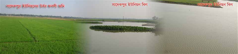
It is a part of Bhairab upazila under Kishoreganj district which is known as Sadekpur. 1. Size-15.42 sq km 2. Population-male: 7725, Female: 8333 3. Mauja no-2 (Sadekpur and Rasulpur Mouza) 4. Number of villages-9 5. Number of Mints - 3510 6. Number of wards-9 7. Total land area - 2335 acres (A) Area of cultivable land - -2002 acres (B) The house is closed in the -177 acres (C) cultivation cultivable -1783 acres (D) Under irrigation -1492 acres (E) Permanent cultivable -13 acres
8. Number of agricultural households -182 9. Number of landless families 10. Number of non-agricultural families -876 11. Food demand- 12. Food Production - Educational Institution 13. Number of schools of Hai-2 14. Number of Primary Primary School-3 15. Number of Primary Schools of Begarsar-3 16. Number of Cards Garten-1
17. Number of Community Schools-2 18. Number of madrasas -5 Religious place of worship 19. Number of masons - 22 20. Number of monuments -1 21. Number of ginners - not only Communication system 22. Pacca Road Quantity -4 Keys Mr. 23. The amount of raw road -7 key Mr. 24. Road route - 8 km 25. Suitable canals - 26. Duvinbant Kutcha Road- 12 Mr.1. Size-15.42 sq km
|


Planning and Implementation: Cabinet Division, A2I, BCC, DoICT and BASIS
Technical Assistance:
![]()
Developed By: